Here comes our latest surprise at Hey Iceland! A selection of hiking trails around Iceland to satisfy the outdoor enthusiast in you! Spread over the country, our selection of hikes are short, duration varying from 0.5 to 4.5 hours, with moderate levels of difficulty - from Easy to Medium. They have the great advantage of being located in the vicinity of our accommodation partners. We at Iceland are delighted to sponsor these trails on the Wapp walking app (available on Google Play and in the Apple Store, which allows you to:
- Check the detailed itinerary and prepare accordingly
- Download the hiking route for free on all your devices and get real-time GPS assistance
- Learn interesting facts along the way and read about legends that have arisen from the place
- Warn the 112 service of your departure for safety reasons
- Browse more trails nearby!
This week, we invite you to check 5 trails in the Southern region! Happy hiking!
Midfell
- Location: Mt. Midfell
- GPS Coordinates: 64.1189380, -20.3176
- Region: South
- Duration: 2 hours
- Difficulty: Medium
- Distance: 4418m
- Height: 101m
- Increase: 173m
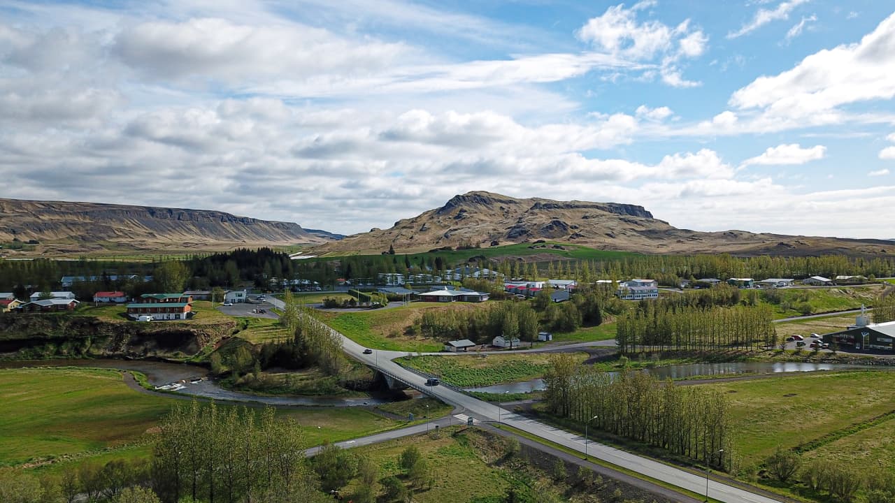
Photo Source: Visit South Iceland
Miðfell is the closest mountain - or fell - to Flúðir village. This is a beautiful mountain with a breathtaking view and in good weather, it is heavenly to rest next to the lake on top and listen to the birds. Miðfell is the result of many eruptions with the oldest dating back to three million years. Repeated ice ages rubbed and molded the mountain as well as its sister mountain Vorðufell which can be seen in the Southwest. Towards the East, the farm Galtafell can be seen next to a mountain with the same name. The sculptor Einar Jónsson was born at that farm and many say the scenery can be recognized in Einar’s work.
When the conditions are good, it is possible to see all the way to the glaciers in the highlands, making the mountain a fairly good viewpoint despite its low height. The route to Miðfell is not very steep, but one should be careful in winter and bring cleats along as the path might be slippery.
Accommodation nearby: Guesthouse Dalbær III - Cottage Hrossagi 2 - Guesthouse Álftröð
SELJALANDSFOSS AND GLJÚFRABÚI
- Location: Seljalandsfoss
- GPS Coordinates: 63.6152980,-19.9937
- Region: South
- Duration: 1,5 hours
- Difficulty: Easy
- Distance: 2246m
- Height: 78m
- Increase: 23m
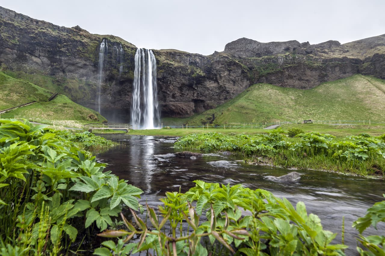
Photo Source: Visit South Iceland
Seljalandsfoss is the foremost waterfall in Seljaland River which runs from Hamragarðar and Seljaland Moor. The waterfall is 62 m high and falls off ancient sea cliffs. When the climate started warming up towards the end of the last ice age, the ice melted fast and sea levels rose. The land had sunk into the earth’s mantle from the weight of the ice and rose so slowly that the whole South Iceland was submerged for hundreds of years. During that time, the sea managed to shape cliffs far inland, including the cave where Seljalandsfoss falls. Gradually the land rose and the sea moved further out.
You can walk around Seljalandsfoss by going into the cave and looking at the waterfall from all angles. Going through the spray from the waterfall, you will get wet, but the cave itself is dry. On sunny days, a rainbow forms at the waterfall. The landscape there will leave you speechless, from green hills and cliffs, to waterfalls and caves, not to mention Markarfljót River.
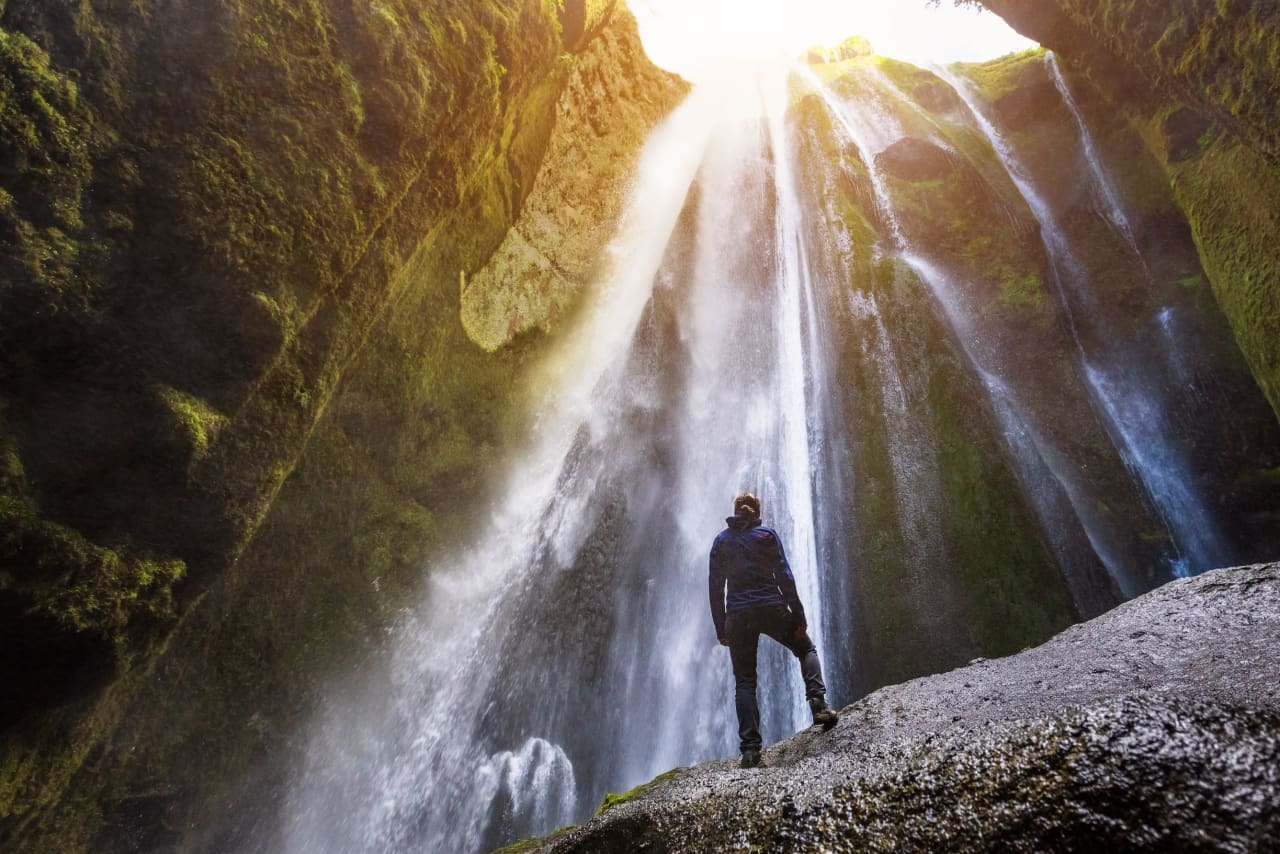
Photo Source: Visit South Iceland
Once you’ve gone behind Seljalandsfoss, the path lies along the Fossatún towards a power station in Hamragarðar, dating from 1923, and from there to the waterfall Gljúfrabúi. It is possible to hike into the canyon, all the way to the waterfall. This hike is suitable for everyone. Caution must be exercised at Gljúfrabúi and in winter the paths can be slippery, it’s advisable to wear cleats.
Accommodation nearby: Hotel Selja - Guesthouse Stóra-Mörk III - Country Hotel Anna & Apartments
HELLUR NEAR REYNISFJARA
- Location: Hellur
- GPS Coordinates: 63.4044500,-19.0456
- Region: South
- Duration: 2 hours
- Difficulty: Medium
- Distance: 1725m
- Height: 7m
- Increase: 12m
The farm Hellur in Reynishverfi has been deserted for many years and now belongs to Garðar Farm. It holds protected archaeological artefacts, including the old farm ruins where fire priest Jón Steingrímsson once lived with his family after they arrived from the North. This short hike lies to the caves on Hellnar Peninsula, there are a few of them and the family made various use of them. You will see for instance the Living Room Cave (Baðstofuhellir), where Jón lived for the first Winter. Visitors are asked to treat the place with respect, not to cross fences onto cultivated land, and stay below the peninsula, except when looking at the ruins and Living Room Cave.
Note that the land beneath the peninsula is often wet, so waterproof shoes are advised . At high tide, the sea can cover almost up to the peninsula, making the trail impassable. Please park at the car park by Reynisfjara, and in Spring and Summer, you are kindly asked not to interrupt the sheep with their lambs.
Accommodation nearby: Giljur in Mýrdalur - Country Hotel Dyrhólaey - Farmhouse Lodge Skeiðflöt
ÁSTARBRAUTIN (THE LOVE TRAIL)
- Location: Kirkjubæjarklaustur
- GPS Coordinates: 63.793,-18.041900
- Region: South
- Duration: 2 hours
- Difficulty: Medium
- Distance: 4100m
- Height: 38m
- Increase: 135m
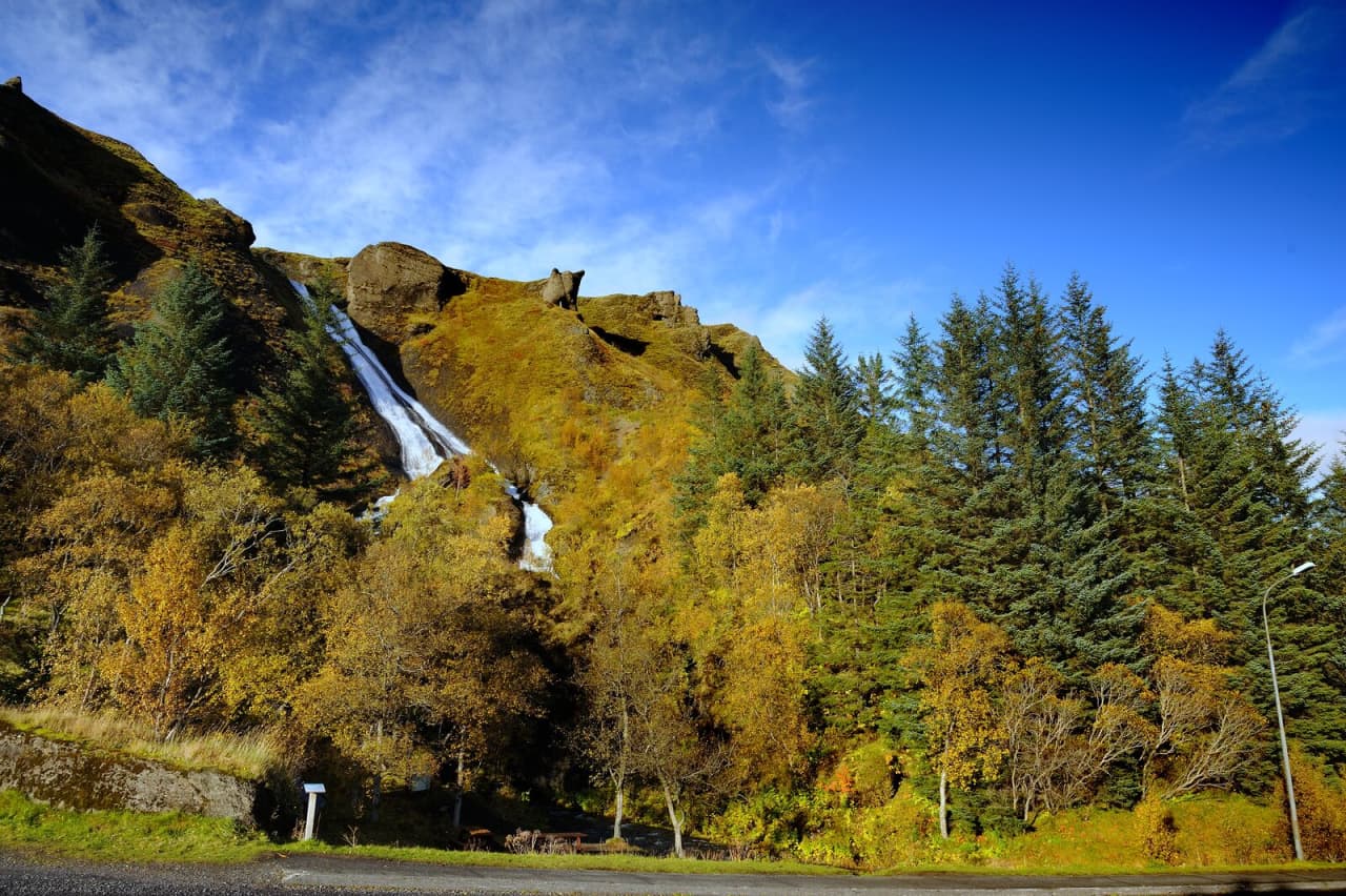
Photo Source: Visit South Iceland
Ástarbrautin is a beautiful trail across the heath above Kirkjubæjarklaustur. It provides a lovely view of Landbrotshólar and beyond, heads past the gorgeous Systrafoss (Sisters' Waterfall) and along Systravatn (Sisters' Lake). This has long been considered a very romantic walk, and has started many beautiful relationships in the area. The trail is suitable for everyone in Summer, but it can be much trickier in Winter, when you'll need suitable gear, such as cleats and warm clothing.
Accommodation nearby: Dalshöfði B&B - Hunkubakkar Guesthouse - Country Hotel Laki
HJALLANES CIRCLE
- Location: Hjallanes
- GPS Coordinates: 64.2479670,-15.6866
- Region: South
- Duration: 2,5 hours
- Difficulty: Medium
- Distance: 8100m
- Height: 33m
- Increase: 143m
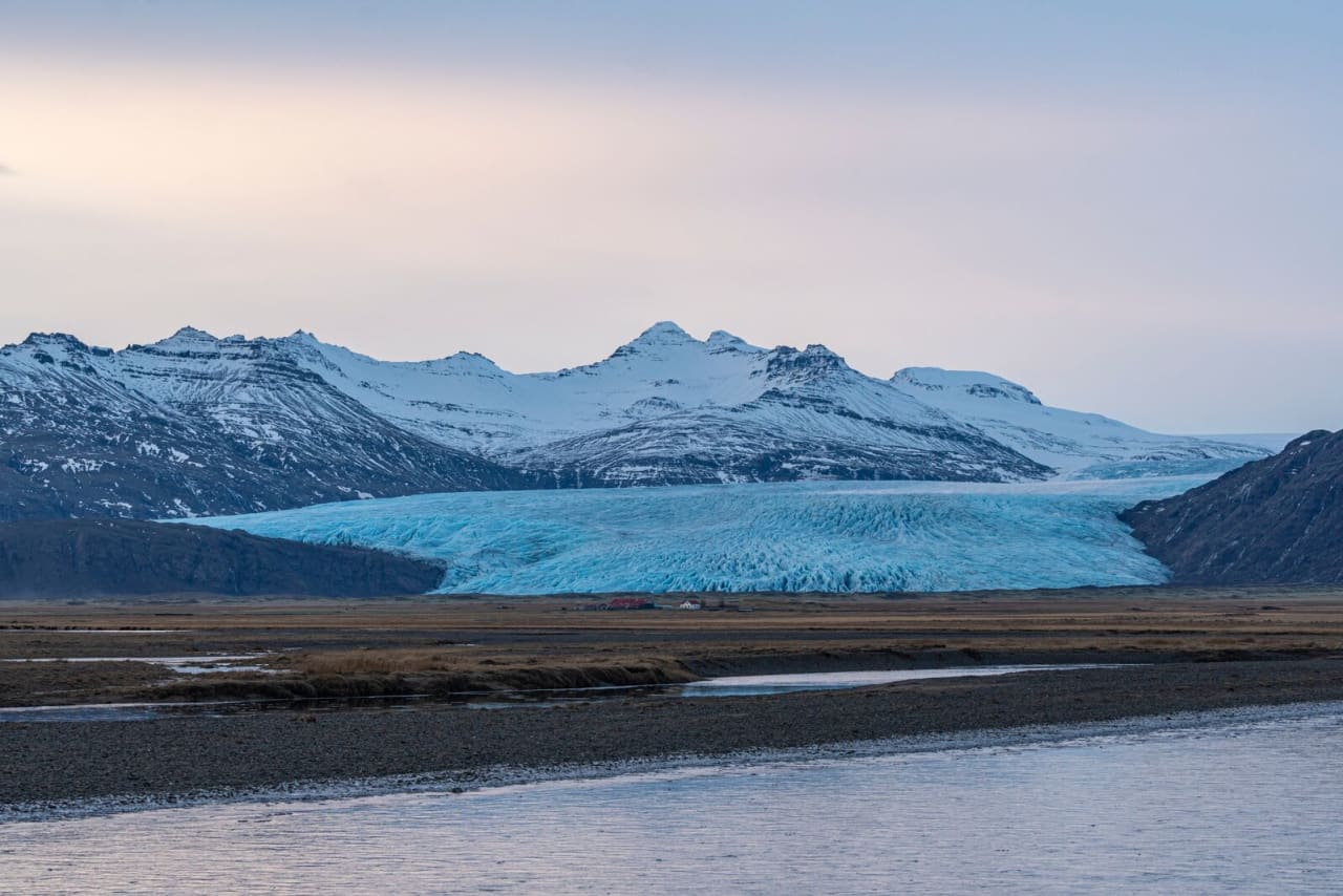
Photo Source: Visit South Iceland
You set off from the farm, towards the East, past a burial mound of a prophetess. A little further East there is an old fireplace, made out of turf and rock, used in the past to wash wool. Above the Skálafell fields lies the awesome Kistugil (Chest Canyon). Legend has it that there is hidden a chest full of gold, there’s no harm in taking a close look into the canyon. Once on the top of Hjallanes, there are various signs of how the glacier has shaped the landscape, as the whole of Hjallanes was covered by Skálafellsjökull a hundred years ago. From Autumn and until Spring, chances to spot reindeers in this area are good, and even foxes. In Summer, it’s all about birdlife and sheep roaming free.
It can be risky to venture too close to Skálafellsjökull, as there is ice underneath the moraines, at quite a distance from the actual edge of the glacier, and when the ice melts, dangerous waterholes can form. The glacial river Kolgríma flows from beneath Skálafellsjökull, and Heinabergsvötn glacial river runs from Heinaberg Lagoon to Kolgríma, forming a sizeable river. The latter half of this hike follows vegetated slopes along Kolgríma back to Skálafell. You pass a quarry by the river with some beautiful plagioclases (crystals which stand out from the dark rocks). Rocks were actually taken from the quarry to build the sea walls in Hornafjörður harbour.
Accommodation nearby: Guesthouse Skálafell I - Guesthouse Stekkatún - Smyrlabjörg Country Hotel
To be well prepared, make sure to check out the Things to Know Before a Hiking Trip in Iceland, and Top 10 Things to Pack for a Hiking Trip!